10. GPS HUD
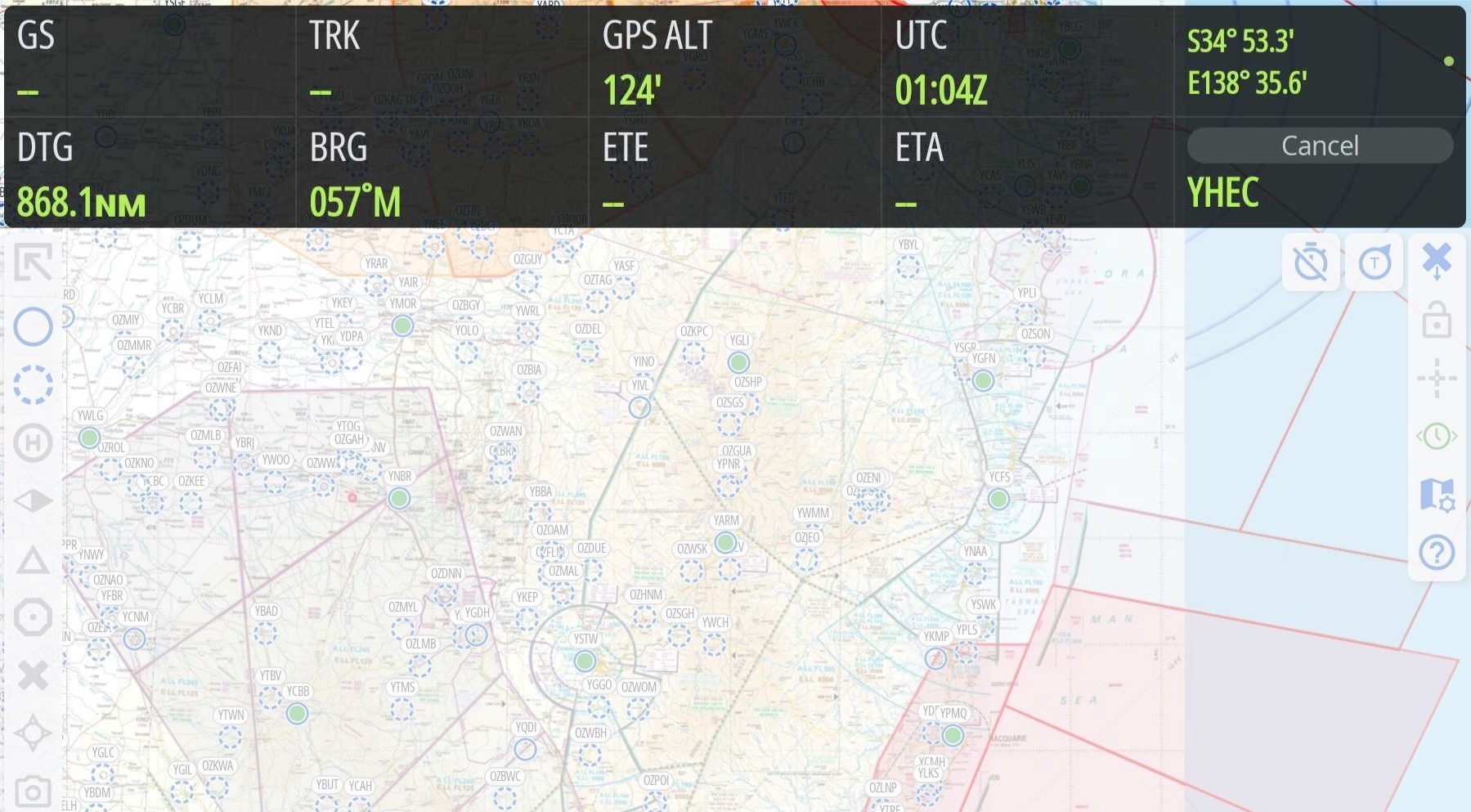
Image 10.1 GPS HUD
The GPS HUD appears across the top of the Map Page (Image 10.1). With no plan selected there is only one row of fields.
When you begin to plan, the GPS HUD converts to a two row display. The plan is now active and if desired can track your position on the map and update the GPS HUD fields with information such as Track, Ground Speed, Distance To Go, etc. The far right bottom box is the ‘Cancel’ box which, if tapped and held, will exit the current plan.
If you don’t want the GPS HUD displayed tap the Map View Options button and turn off ‘Show GPS HUD’. A long press on any of the GPS HUD boxes will bring up a list of available fields. Tap an item in the list to switch the GPS HUD box to the selected data option.
Some data requires an accurate GPS signal (think GS, ETA etc.), or an internet connection (QNH, TMP). If data is not available due to lack of GPS signal or internet connection then ` – ` will be displayed.
In the top right corner of the GPS HUD there is a small coloured dot. This is explained below in GPS Accuracy Dot
10.1. HUD box options
Tap and hold (long press) on any GPS HUD field and a popup will result displaying various option as described below (Image 10.2):
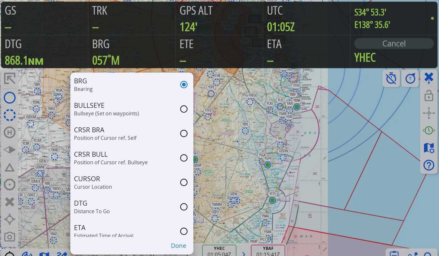
Image 10.2 GPS HUD Options
- BRG
Bearing to next waypoint
- CRSR BRA
Position of Cursor referenced to yourself
- CURSOR
When the cursor is enabled, this will display the position of the cursor location in reference to your current position
- DTG
Distance to go; distance remaining until reaching next waypoint
- ETA
Estimated Time of Arrival at next waypoint
- ETE
Estimated Time Enroute
- FREQ
Centre Frequency
- FREQ/NXT
Current and next Centre frequency combined into one box
- FREQ NEXT
Next centre frequency based on your current heading
- GPS Error
Displays the current GPS error as calculated by the device. The lower this is, the better fix you have. It can be used to give you an indication of the best place to position your device in the aircraft.
- GS
Ground Speed in knots.
- HSI
Horizontal Situation Indicator. A mini version of the HSI is displayed. At the bottom of the mini-HSI a ‘t’ bar indicates deviation left or right of track. The arrow indicates the bearing to the waypoint to which you are tracking.
- LAT
Current GPS latitude
- LAT/LON
Current GPS latitude/longitude consolidated in one box
- LCL
Local Time (device timezone)
- LON
Current GPS longitude.
- MGRS
Military Grid Reference System
- TRK
Current GPS track
- TRK (CARD)
Current GPS track in a compass card format
- UTC
UTC (Zulu) Time
- UTM
Universal Transverse Mercator
- UTM
Universal Transverse Mercator with Military Grid Reference System band
- VS
Vertical Speed
- XTK
Cross Track Error
10.2. GPS Accuracy Dot
In the top right corner of the GPS HUD there is a small coloured dot. The colour of the dot gives a quick visual indication of horizontal GPS accuracy as follows:
Green: Good accuracy, 30m or less
Yellow: Poor accuracy, between 30m and 200m
Magenta: Very poor accuracy, between 200m and 5km
Red: No GPS signal
If horizontal GPS accuracy is worse than 200m (i.e. a magenta or red dot) OzRunways will no longer display your location on the map, other data in the HUD that relies on GPS position may no longer function. If this happens, check that OzRunways has the approproiate permissions to access location services in the device settings. You may need to move the device to a different location in the aircraft away from any obstructions.